 -
- 
-
A good starting point is print-outs of what you already know of the area,at a good high scale. These can be carried on-the-ground and annotated, then at home transferred to a computer. This job is done by the MAPPERS.
It can also be helpful to look at Google maps or other aerial/satellite views.
So a small bitmap area, acceptable printed at 100%,
But...
A lot of work to do, again!
O-CAD is not easy for beginners- you have to know which symbol represents what, and how to create and adjust all the separate elements which are in some ways like a layered series of items stacked above each other.
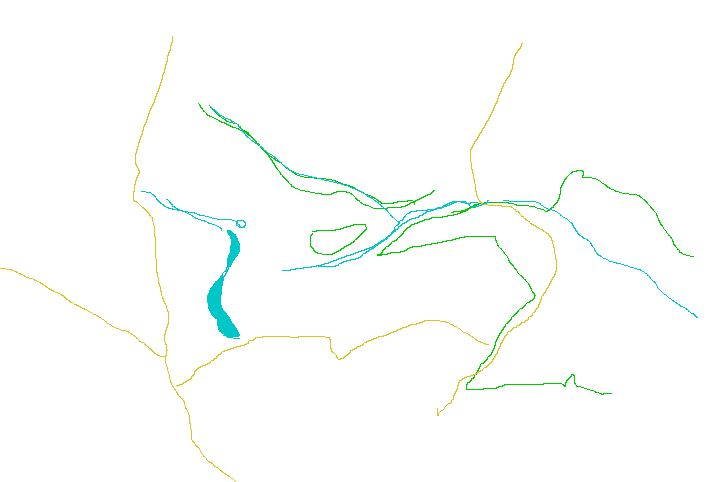
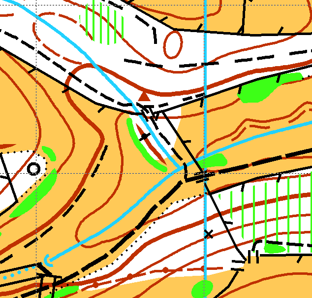
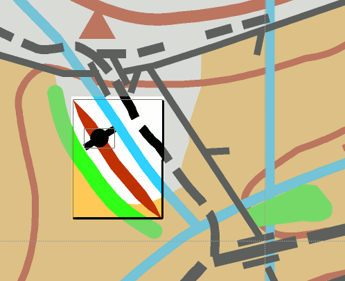
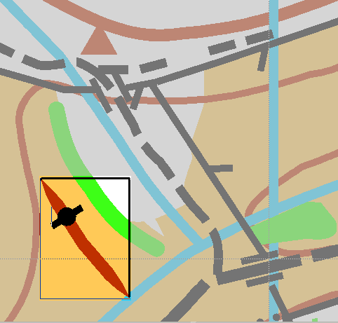
The image above shows two elements ( in red and black) have been selected- they could be removed or moved or be altered in colour or size, leaving everything else on the map un-changed. I've lowered the contrast of the bits that are staying fixed behind the selection. Usual choice when selecting is that only objects WHOLLY INSIDE the selection box are chosen, and they move as if drawn on a transparent sheet across the other objects.
In the second image they have been moved.
Like all software, a little time spent with an existing user will REALLY help you get going with OCAD.
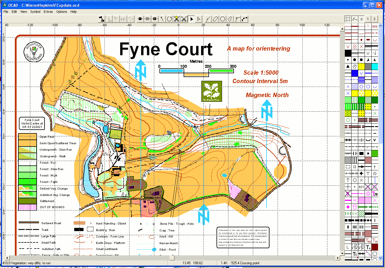
O-CAD mapping software
The software QO use for maps is O-CAD. This is commercial software and the latest versions have all sort of bells and whistles, but O-CAD 6 is fine and is distributed freely.
Vector files v/ Bitmap images.
O-CAD produces what are called 'vector files', which means the information is coded as coordinates and colours. Instead of a line being a row of pixel coloured dots on a screen, as shown in a 'bitmap' image below, it is stored as its start and end point coordinates, and the colour, as eg '123.45,54.67, 112.0, 65.11, black, dashed, 1.2' for a black dashed line, width 1.2, between (123.45,54.67) and (112.0, 65.11). Longer descriptions might include a series of co-ordinates round a closed irregular shape, and the colour to fill the enclosed area. This descriptive way of saving map details is never visible to the user, who draws the shape with hand and mouse, but means it can be drawn pixel-perfect and also takes less storage space and if printout is scaled up it doesn't become a staircase of big blocks!
 - - enlarges raggedly into - -
 - - - enlarges smoothly to - - -
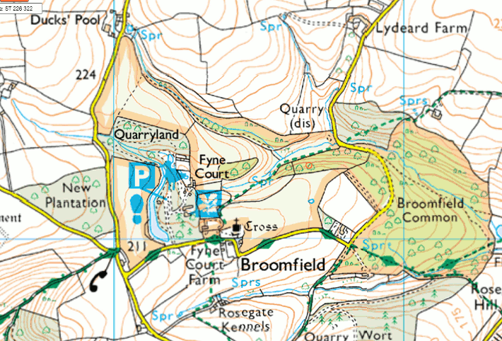
O-CAD maps are stacks of MANY separate features.
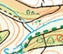
All the areas of colour; all the line features; all the spot-features- they have to be entered by hand and mouse. On the map section below, there are large irregular areas of runnable open land and forest; earth banks; streams; crossing points; form lines; 'fight' in the woods Areas of open run and of forest run need refining with areas which are all the way to fight or out-of-bounds.
 -
- 
The QO Mapping Officer keeps the current maps, and updates them whenever he is notified ( by planners or others) of any changes.
Back to start page.